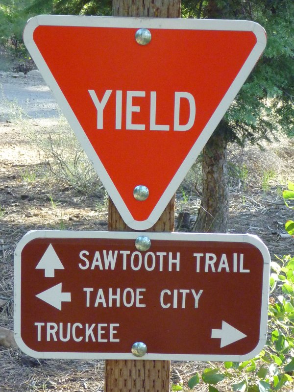

At the beginning of the loop is a sign that posts the two directions “SAWTOOTH TRAIL” and “SAWTOOTH ROAD.” Following the former (counterclockwise looping), you'll continue along the Truckee River canyon. Following the other direction (clockwise looping), you'll cross the Sawtooth Road (FS Road 06) and continue through forest with areas of dense growth of Chinquapin bushes. The southernmost sections of the loop trail will take you close to various meadows of the Martis Creek area, which exhibit, in spring, a richness of wildflowers including buttercup, lupine and penstemon. According to the trailhead signboard, there is a chance of seeing interesting animal species in or above the sawtooth forest: frogs, toads, salamanders, snakes and turtles; foxes, fishers, martens and weasels; bald eagles, hawks and owls. 
Rock and boulder site Getting to the Sawtooth trailheadsFrom the intersection of Donner Pass Road and Bridge Street in Truckee, drive about 0.3 miles south-southwest on Brockway Drive and turn right on Palisades Drive. Follow this road for 0.4 miles until it turns left and continues as Ponderosa Drive. Continue on for less than a mile and turn right onto Silver Fir. At the intersection of Silver Fir and Thelin Drive, turn left and then veer right onto FS Road 06. This road is closed by a locked gate during winter months. Notice that Placer County does not allow roadside parking from November to April. Once on FS Road 06 you'll pass a sign displaying a distance of 11 miles to Watson Lake and 16 miles to Brockway Summit. The paved road turns into a gravel road past this sign. You'll find trailhead parking to the right. Further trail access parking is available after 1.6 miles (beginning of the loop trail) and after 4.5 miles (southernmost point of the sawtooth loop). |
||||||||
Nearby trails and places of interest
|
||||||||
Selected descriptions, maps and links
|
|
Tweet
__ __ 
__ 
|
|
| Around Truckee, California |
|
Donner Party Memorial Donner Lake Rim Trail (DLRT) Summit Lake Martis Creek Trail Martis Peak Fire Lookout |
|
|
Trailing Ahead |
| Video Maker |

Custom Search
|